MAPPING LATIN AMERICA
Latin America Mapping Links…
Latin America Political Map (Blank Downloadable Copy)
Latin America Physical Map (Blank Downloadable Copy)
Geo Mapping Rubrics
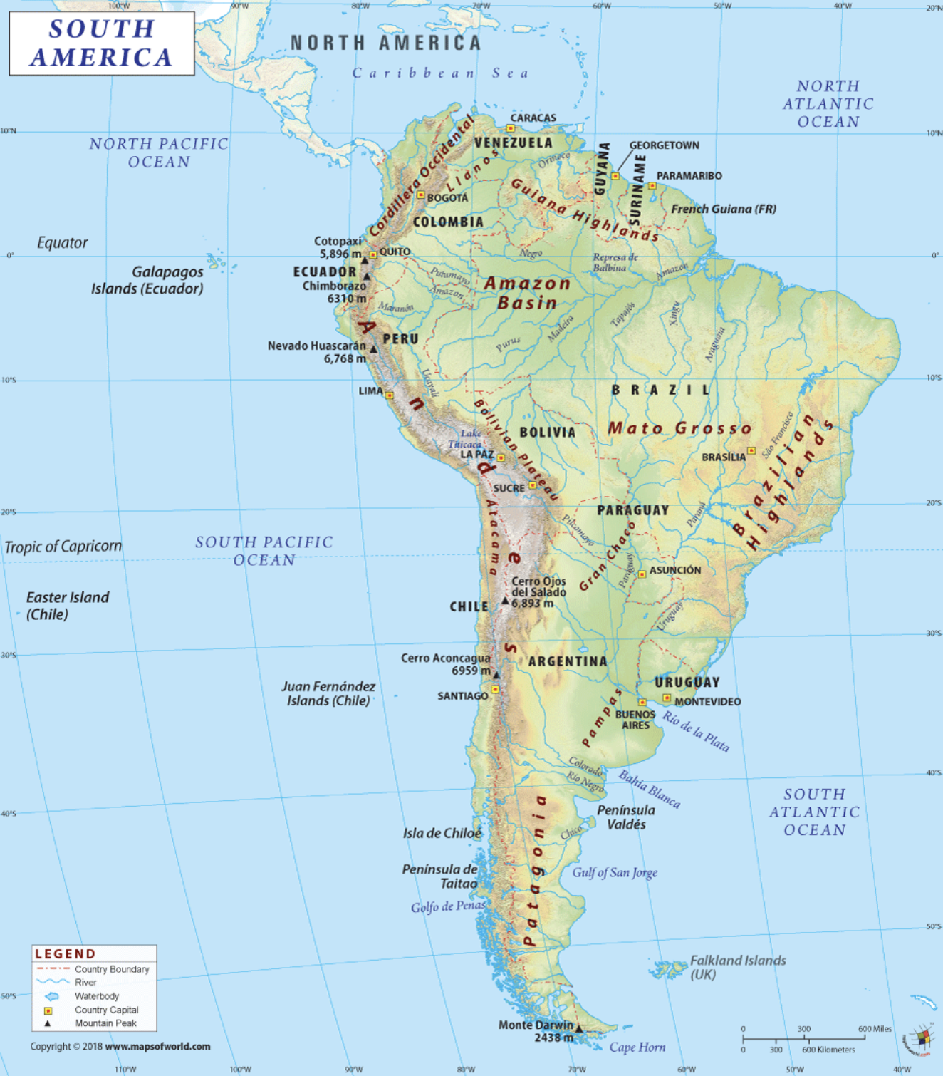
LA “Power” Country List (Political Map)
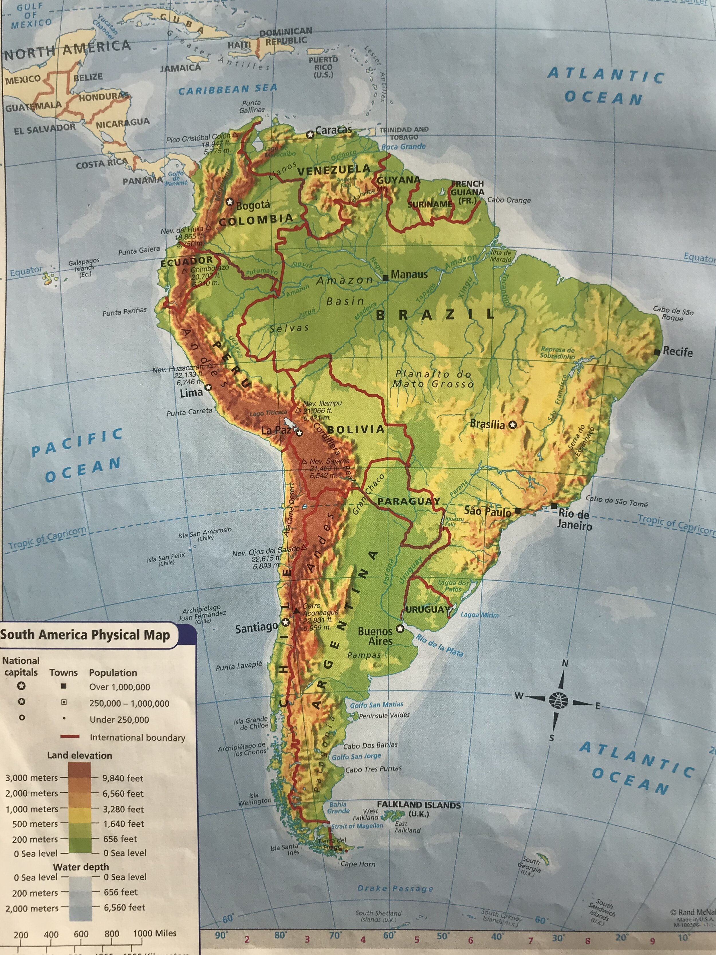
LA “Power” Feature List (Physical Map)
LA Political Map Test - Power Country Locations Quizlet
LA Power Countries & Capitals Quizlet
LA Physical Feature Quizlet
World Geo Games
Sheppard Software (Map Study Games)
Note: Attention Geographers…reminder that “Latin America” in NOT a Continent. As a Geography class, we study the regions of Mexico, Central America, Caribbean Islands and the CONTINENT of South America during out Latin America Unit. Yes, this does cause confusion at times!
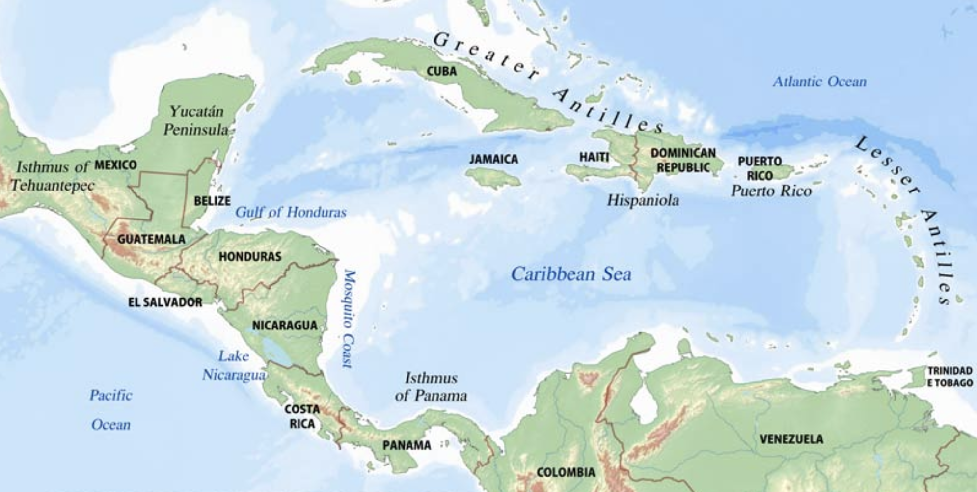
LATIN AMERICAN POLITICAL MAPS


LATIN AMERICAN PHYSICAL MAPS


Just cant’t seem to find the right map for the job? Check the site linked below…Simply type in a country, continent or region and this site usually has a match…enjoy! (AND if all else fails GOOGLE IT)
Mapsof.net
POLITICAL AND PHYSICAL MAPPING CHECK LIST
Political Maps
_____ ALL Political Features from List have been Located and Labeled Neatly
_____ Political Features have been colored…no two “touching” political boundaries are colored
in the same color
_____ Basic Scale Chart has been added
_____ Map includes a Compass Rose
_____ Neatly Colored using Colored Pencil
_____ Labeling is neat (legible) and is in BLACK ink
_____ Capitalize ALL Proper Nouns ex/ Brazil
Physical Maps
_____ ALL Physical Features from List have been Located and Labeled Neatly
_____ Land Elevation changes throughout map have been colored
_____ ALL Water Features (Rivers, Lakes & Oceans) have been colored blue
_____ Basic Scale Chart has been added
_____ Map includes a Compass Rose
_____ Neatly Colored using Colored Pencil
_____ Labeling is neat (legible) and is in BLACK ink
_____ Map Includes Detailed Key/Legend (includes Mtns, Elevation, Rivers, Water, etc…)
_____ Capitalize ALL Proper Nouns ex/ Amazon River